mNo edit summary Tag: rte-source |
No edit summary Tag: sourceedit |
||
| (6 intermediate revisions by the same user not shown) | |||
| Line 1: | Line 1: | ||
{{Country |
{{Country |
||
| − | | name = |
+ | | name = Freistaat Rotinsel<br />Wladwriaeth am ddim o Ynysoedd Coch |
| − | | name_en = |
+ | | name_en = Free State of the Red Islands |
| name_short = Rotinsel |
| name_short = Rotinsel |
||
| game = New World |
| game = New World |
||
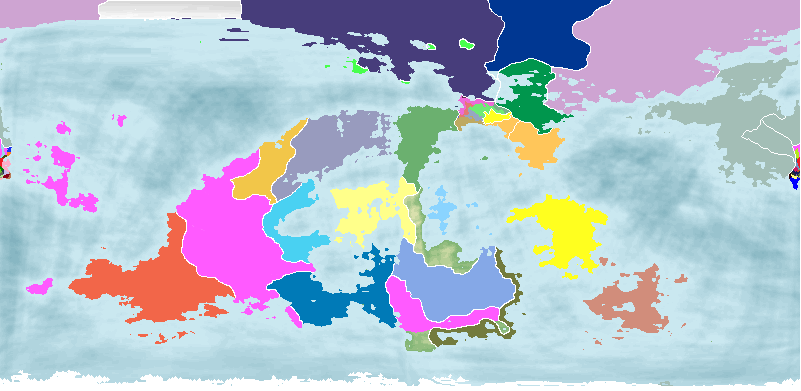
| map = NewWorldLocatorMap_1016.png |
| map = NewWorldLocatorMap_1016.png |
||
| flag = Flag of Rotinsel.png |
| flag = Flag of Rotinsel.png |
||
| − | | coa = Coat of arms of |
+ | | coa = Coat of arms of Rotinsel.png |
| motto = Ein Reich, Ein Tir, Ein Mam |
| motto = Ein Reich, Ein Tir, Ein Mam |
||
| motto_lang = Welsh |
| motto_lang = Welsh |
||
| motto_en = Our Reich, Our Land, Our Mother |
| motto_en = Our Reich, Our Land, Our Mother |
||
| − | | Anthem = [[National Anthem of Neubayern (New World Map Game)|May our Land save our great |
+ | | Anthem = [[National Anthem of Neubayern (New World Map Game)|May our Land save our great Kaiserin]] |
| capital = St Martinsburg |
| capital = St Martinsburg |
||
| city_other = New Königstadt, Aurorastadt, New Kaiserburg, Eryrdydd (Adlerburg) |
| city_other = New Königstadt, Aurorastadt, New Kaiserburg, Eryrdydd (Adlerburg) |
||
| Line 21: | Line 21: | ||
| demonym = Rotinselian |
| demonym = Rotinselian |
||
| regime = Constitutional monarchy |
| regime = Constitutional monarchy |
||
| − | | CoGtitle = |
+ | | CoGtitle = Staatsleiter |
| − | | CoGlist = |
+ | | CoGlist = Staatsleiters of Neubayern (New World Map Game) |
| − | | CoGname = [[ |
+ | | CoGname = [[Dafydd ap Enwilyn (New World Map Game)|Dafydd ap Enwilyn]] |
| HoStitle = Kaiser |
| HoStitle = Kaiser |
||
| HoSlist = Kaiser of Neubayern (New World Map Game) |
| HoSlist = Kaiser of Neubayern (New World Map Game) |
||
| − | | HoSname = [[ |
+ | | HoSname = [[Helena of Neubayern (New World Map Game)|Helena]] |
| population = 52,830 (1016 census) |
| population = 52,830 (1016 census) |
||
| est_date = 21st October 1015 |
| est_date = 21st October 1015 |
||
| − | | currency = |
+ | | currency = Neubayero-Donetskian krone (NDK) |
}} |
}} |
||
| − | '''Rotinsel''', officially the ''' |
+ | '''Rotinsel''', officially the '''Free State of the Red Islands''' (German: ''Freistaat Rotinsel'') is a Free State of the [[United Reich of New Bayern (New World Map Game)|United Reich of New Bayern]], located on an island group off the eastern coast of Terra Rossa. Rotinsel was established in 1015 as an Imperial Colony after it was deemed suitable for Neubayerisch colonisation. There was little resistance on the part of the natives to the Neubayerisch colonists, and some tribes openly embraced Neubayerisch rule and modernisation. The settlers, mostly concentrated in the colonial capital of St Martinsburg and the other settlements of New Königstadt, Aurorastadt and Kaiserburg. Another city was built for the natives, Eryrdydd, although in the decades since then multiculturalism has become a feature of Rotinselian cities in general. After the ''Umstrukturierung'' program, Rotinsel was transformed into a fully integrated Free State of the Reich. |
| − | |||
| − | Currently, Rotinsel has no representation in Neubayern's national legislature, [[Reichsparlament of New Bayern (New World Map Game)|Reichsparlament]]. Instead, it is controlled directly by the Reich Government through a Governor appointed by the Government to represent both it and the Kaiser. The first and current Governor of Rotinsel is [[Dörthe von Braun (New World Map Game)|Dörthe von Braun]]. |
||
Rotinsel has a proportionally large young population: approximately 65% of all people living in the Colony are under the age of 18. As such, many schools have been built all across the islands to cater for all the children living on the Colony. |
Rotinsel has a proportionally large young population: approximately 65% of all people living in the Colony are under the age of 18. As such, many schools have been built all across the islands to cater for all the children living on the Colony. |
||
| − | + | Rotinsel has an ethnic majority of Welsh, who migrated centuries prior to what is now Rotinsel from the Terra Rossian mainland. |
|
[[Category:New World (Map Game)]] |
[[Category:New World (Map Game)]] |
||
Revision as of 02:45, 18 November 2015
Motto | |||||||
| Anthem | "May our Land save our great Kaiserin" | ||||||
| Capital (and largest city) |
St Martinsburg | ||||||
| Other cities | New Königstadt, Aurorastadt, New Kaiserburg, Eryrdydd (Adlerburg) | ||||||
| Language official |
German, Welsh | ||||||
| others | English | ||||||
| Religion main |
None (secular government) | ||||||
| others | Lutheranism, Albanism | ||||||
| Ethnic groups main |
Welsh | ||||||
| others | Germans, Asians | ||||||
| Demonym | Rotinselian | ||||||
| Government | Constitutional monarchy | ||||||
| Kaiser | Helena | ||||||
| Staatsleiter | Dafydd ap Enwilyn | ||||||
| Population | 52,830 (1016 census) | ||||||
| Established | 21st October 1015 | ||||||
| Currency | Neubayero-Donetskian krone (NDK) | ||||||


Rotinsel, officially the Free State of the Red Islands (German: Freistaat Rotinsel) is a Free State of the United Reich of New Bayern, located on an island group off the eastern coast of Terra Rossa. Rotinsel was established in 1015 as an Imperial Colony after it was deemed suitable for Neubayerisch colonisation. There was little resistance on the part of the natives to the Neubayerisch colonists, and some tribes openly embraced Neubayerisch rule and modernisation. The settlers, mostly concentrated in the colonial capital of St Martinsburg and the other settlements of New Königstadt, Aurorastadt and Kaiserburg. Another city was built for the natives, Eryrdydd, although in the decades since then multiculturalism has become a feature of Rotinselian cities in general. After the Umstrukturierung program, Rotinsel was transformed into a fully integrated Free State of the Reich.
Rotinsel has a proportionally large young population: approximately 65% of all people living in the Colony are under the age of 18. As such, many schools have been built all across the islands to cater for all the children living on the Colony.
Rotinsel has an ethnic majority of Welsh, who migrated centuries prior to what is now Rotinsel from the Terra Rossian mainland.